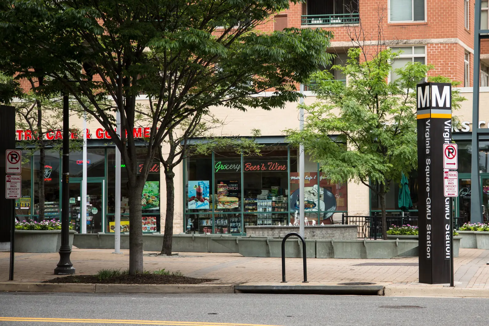
Virginia Square is a 190-acre county planning area in ZIP codes 22201 and 22203, zoned for Washington-Liberty High, with Quincy Park and Central Library.
Last checked Oct. 19, 2026. The boundary is Arlington County’s Virginia Square planning area, from the county’s Planning Areas map layer, and the Virginia Square Sector Plan (2002, PDF). School zones come from the boundaries behind Arlington Public Schools’ boundary locator; ratings from the Virginia Department of Education’s 2026-27 framework summary for Arlington (PDF); home values from the Zillow Home Value Index (Zillow Research); parks from the county’s parks map layer; bus routes from Arlington Transit’s published schedule data; place names, stores and road distances from OpenStreetMap (© OpenStreetMap contributors).
Virginia Square is the 190-acre planning area around Virginia Square-GMU Metrorail station, between Clarendon and Ballston. The county’s 2002 Virginia Square Sector Plan, a revision of a 1983 plan, says the area “is bordered by Clarendon on the east and Ballston on the west” and names George Mason University among the major institutions inside it. Arlington’s Central Library and Quincy Park are inside it too.
What this means for you
- Zoned high school: Washington-Liberty High School (the whole planning area)
- Typical home value: $699,223 in ZIP 22201 and $642,144 in 22203, September 2026, according to Zillow
- Nearest interstate exit: I-66 Exit 71 (VA 120, Glebe Road), about 1.1 miles by road
- Zone questions: Arlington Public Schools, 703-228-8000
Where it is
The planning area runs along Fairfax Drive and Wilson Boulevard from about North Kirkwood Road, at the Clarendon end, west to North Quincy Street, where Ballston begins. Washington Boulevard runs along part of its northern edge. About 57% of the area is in ZIP 22201 and 43% in 22203.
On the county’s civic association map, the area is split almost evenly between Ashton Heights, to the south, and Ballston-Virginia Square, to the north. OpenStreetMap marks Virginia Square as a neighborhood inside it.
Schools
The area is split between two elementary and two middle school zones.
| School | Share of area | Grades | Address | 2026-27 rating |
|---|---|---|---|---|
| Long Branch Elementary | about 52% | PK-5 | 33 N. Fillmore St. | Approaching Expectations, 89.2 |
| Arlington Science Focus | about 48% | PK-5 | 1501 N. Lincoln St. | Distinguished, 96.3 |
| Jefferson Middle | about 52% | 6-8 | 125 S. Old Glebe Road | Approaching Expectations, 87.2 |
| Swanson Middle | about 48% | 6-8 | 5800 Washington Blvd. | Distinguished, 90.6 |
| Washington-Liberty High | all | 9-12 | 1301 N. Stafford St. | Meets Expectations, 92.2 |
All five are Fully Accredited. The ratings are Virginia’s School Performance and Support Framework category and score for 2026-27, based on 2025-26 results. Check one address in the APS boundary locator, and see our schools guide.
Home values
| ZIP code | Share of area | September 2026 | September 2025 | Change |
|---|---|---|---|---|
| 22201 | about 57% | $699,223 | $688,326 | up 1.6% |
| 22203 | about 43% | $642,144 | $630,889 | up 1.8% |
The figures are Zillow’s Home Value Index, a modeled typical value for mid-priced homes, not a sale price. Zillow’s figure for Arlington as a whole was $801,809 in September 2026, up 1.3%. See our home prices guide.
Parks and trails
From the county’s parks map:
- Quincy Park, 1021 N. Quincy St., about 13 acres, the largest park in the area
- Maury Park, 3550 Wilson Blvd.
- Mosaic Park, 544 N. Pollard St.
- Oakland Park, 3705 Wilson Blvd.
- Herselle Milliken Park, 820 N. Lincoln St.
- Gum Ball Park, 3715 7th St. N.
Central Library, 1015 N. Quincy St., is next to Quincy Park, and George Mason University’s Arlington campus has its own library. More in our parks and trails guide.
Getting around
Distances are measured on the road network from the middle of the planning area (OSRM routing on OpenStreetMap data); they are distances, not drive times.
| To | Distance |
|---|---|
| County government center, 2100 Clarendon Blvd. | about 1.3 miles |
| I-66 Exit 71 (VA 120, Glebe Road) | about 1.1 miles |
| I-66 Exit 72 (U.S. 29, Spout Run Parkway) | about 1.4 miles |
| Reagan National Airport | about 5.4 miles |
Virginia Square-GMU Metrorail station, 3600 Fairfax Drive, is inside the area. Ballston station is about 0.2 mile west of its edge and Clarendon about a quarter mile east. Arlington Transit (ART) routes with stops in the area, according to ART’s schedule data:
- ART 41: Columbia Pike, Ballston and Court House
- ART 42: Ballston to Pentagon City
- ART 52: Ballston, Virginia Hospital Center and East Falls Church
- ART 56: Military Road to Rosslyn
- ART 75: Shirlington, Wakefield High School, Carlin Springs Road, Ballston and Virginia Square
See our getting around guide.
Groceries and everyday stores
- Giant, 3450 Washington Blvd.
- CVS Pharmacy, 3336 Wilson Blvd.
- Harris Teeter, 624 N. Glebe Road, just west in Ballston
How to check an address
Look up the parcel on the county’s property search, then check its elementary and middle schools in the APS boundary locator, since Virginia Square is split between zones. Our property tax guide has the county rate, and the Arlington neighborhoods guide covers every planning area.
Frequently asked questions
What high school is Virginia Square zoned for?
All of the Virginia Square planning area is zoned for Washington-Liberty High School, rated Meets Expectations with a framework score of 92.2 in Virginia’s 2026-27 ratings.
What ZIP code is Virginia Square, Arlington?
It is split: about 57% of the planning area is in 22201 and 43% in 22203.
What is the typical home value in Virginia Square?
Zillow’s Home Value Index was $699,223 for ZIP 22201 and $642,144 for 22203 in September 2026, up 1.6% and 1.8% from a year earlier. These are modeled values, not sale prices.
Is George Mason University in Arlington?
Yes. George Mason University’s Arlington campus is in Virginia Square, which the county’s sector plan names as one of the area’s two major institutions, and the Metro station is Virginia Square-GMU.
Have your say