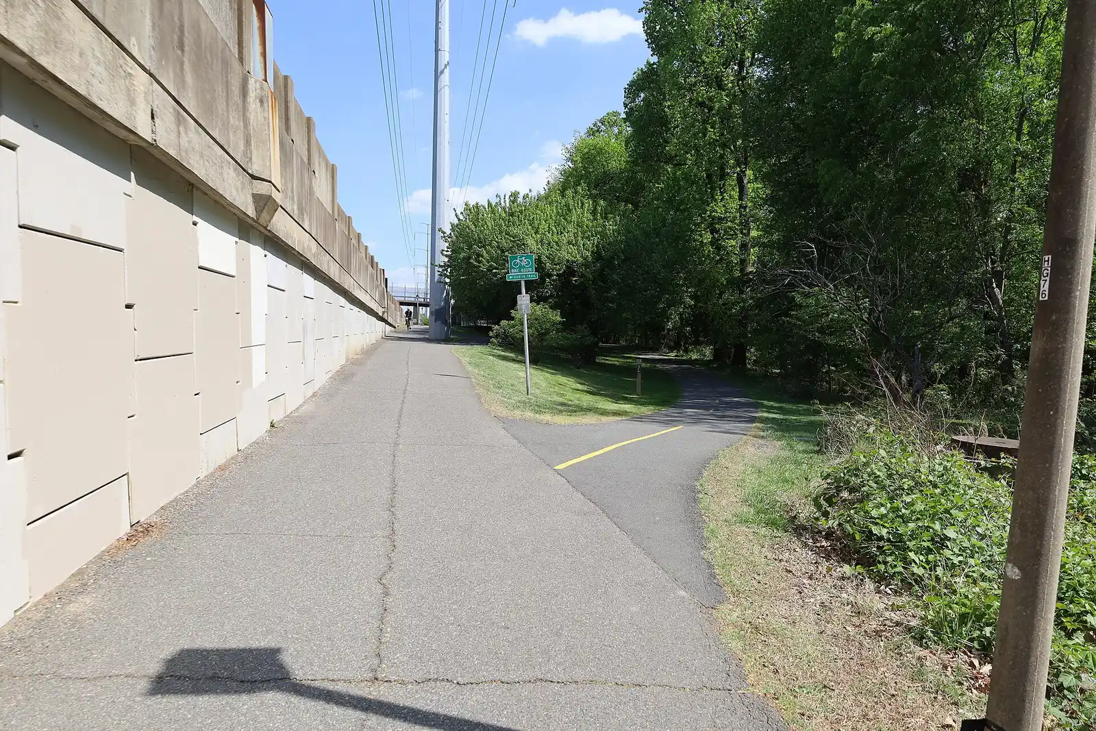
Arlington's main paved trails: Four Mile Run (9.7 miles), Custis (5.1), the W&OD (45 from Shirlington) and the 18-mile Mount Vernon Trail, plus woodland paths.
Last checked Oct. 19, 2026. Lengths and ratings come from Arlington County’s off-street trails page; the W&OD from NOVA Parks; the Mount Vernon Trail from the National Park Service.
Four paved trails carry most of Arlington’s walkers and cyclists: the Four Mile Run Trail across South Arlington, the Custis Trail across North Arlington, the W&OD Trail heading west from Shirlington and the Mount Vernon Trail along the Potomac. They connect, so you can ride a loop or reach Washington without a car. For a fallen tree or a problem on a county trail, call park maintenance at 703-228-6525.
What this means for you
- Hours: county parks and trails are open sunrise to sunset unless posted; the W&OD is open 5 a.m. to 9 p.m., and the Mount Vernon Trail 6 a.m. to 10 p.m.
- Dogs: must be leashed on every trail. See our dog-friendly guide.
- Bikes: allowed on the four paved trails; not on the natural-surface woodland trails.
The big four
| Trail | Length | Rating | Runs between |
|---|---|---|---|
| Four Mile Run Trail | 9.72 miles | Easy to moderate | Falls Church and the Mount Vernon Trail near Reagan National Airport |
| Custis Trail | 5.12 miles | Moderate (hilly) | The Mount Vernon Trail in Rosslyn and the W&OD near Falls Church |
| W&OD Trail | 45 miles | Easy | Shirlington and Purcellville |
| Mount Vernon Trail | 18 miles | Easy | Theodore Roosevelt Island in Rosslyn and Mount Vernon |
Four Mile Run Trail. A paved bike trail that follows the stream from Falls Church to the Mount Vernon Trail near Reagan National Airport, passing Glencarlyn Park, Allie S. Freed Park and Barcroft Park. It splits from the W&OD at Madison Manor Park, in the photo above.
Custis Trail. A hilly paved trail from Rosslyn to the W&OD near Falls Church. Lacey Woods Park and Thrifton Hills Park both have short side trails off it.
W&OD Trail. NOVA Parks’ Washington & Old Dominion Railroad Regional Park is a paved trail on an old rail bed, 45 miles from Shirlington to Purcellville, open 5 a.m. to 9 p.m. daily all year. Riders on horseback use a separate 32-mile gravel horse trail beside it. In Arlington, NOVA Parks lists parking at Bluemont Park, one lot at Manchester and Fourth streets and one off Wilson Boulevard. It says roadside parking in Shirlington is not recommended for leaving a car overnight.
Mount Vernon Trail. The National Park Service’s 18-mile paved trail along the Potomac and the George Washington Memorial Parkway, from Theodore Roosevelt Island to George Washington’s Mount Vernon estate, with views of the Washington skyline. It is open 6 a.m. to 10 p.m.; commuters may use it any time. The park service counts up to 80,000 visitors a month and asks users to keep right and slow down at intersections.
A Ballston loop
The Bluemont Junction Trail, 1.3 miles and easy, is an old rail line that links Ballston with the W&OD and Four Mile Run trails through Bluemont Park. Ride it with stretches of the Custis and W&OD trails to make a loop from Ballston.
Woodland trails to the Potomac
North Arlington’s stream valleys drop to the river. These county trails are natural surface, with stream crossings, and not for bikes:
| Trail | Length | Rating | Start |
|---|---|---|---|
| Gulf Branch Park and Nature Center | 1.4 miles | Moderate to difficult | 3608 N. Military Road, to the Potomac Heritage National Scenic Trail |
| Donaldson Run Park | 0.6 miles, plus 0.15 to the river | Moderate to difficult | 30th Street North and North Military Road |
| Windy Run Park | 0.62 miles | Moderate to difficult | 2420 N. Kenmore St., to the Potomac Heritage Trail |
| Zachary Taylor Park | 1 mile | Easy to moderate | Marymount University at 26th Street to Military Road |
| Dawson Terrace Park (Palisades Trail) | 0.43 miles | Easy to moderate | Behind the community center, 2133 N. Taft St. |
Short walks
| Trail | Length | Rating | Where |
|---|---|---|---|
| Glencarlyn Park and Long Branch Nature Center | 1.2 miles | Easy to difficult | Connects to Four Mile Run, the W&OD and Tyrol Hills Park |
| Lubber Run Park | 0.83 miles | Moderate to difficult | Along the stream from North Columbus and Second streets North |
| Tuckahoe Park | 0.47 miles | Easy | Loop near 2400 N. Sycamore St., near East Falls Church Metro |
| Fort C.F. Smith Park | 0.46 miles | Easy | 2411 24th St. N., a 19-acre park |
| Thrifton Hills Park | 0.39 miles | Easy to moderate | Off the Custis Trail; park at 2814 23rd St. N. |
| Lacey Woods Park | 0.34 miles | Easy | 1200 N. George Mason Drive |
| Rock Spring Park | 0.29 miles | Easy | Yorktown Boulevard and Little Falls Road at George Mason Drive |
Getting there without a car
- The East Falls Church Metro station is near the W&OD and Custis trails, and Rosslyn is at the east end of the Custis and the north end of the Mount Vernon Trail.
- Buses, Metro and the county’s bike network are on our getting around guide.
Related guides: parks and trails, kids’ activities and free things to do.
Frequently asked questions
How long is the Custis Trail in Arlington?
Arlington County lists the Custis Trail at 5.12 miles. The hilly paved trail runs from the Mount Vernon Trail in Rosslyn to the W&OD Trail near Falls Church.
Where does the W&OD Trail start?
In Shirlington. NOVA Parks’ paved W&OD Trail runs 45 miles from Shirlington to Purcellville and is open 5 a.m. to 9 p.m. daily all year.
How long is the Four Mile Run Trail?
9.72 miles, according to the county, from Falls Church to the Mount Vernon Trail near Reagan National Airport. It is paved and rated easy to moderate.
What are the best hiking trails in Arlington, Virginia?
The county’s natural-surface trails at Gulf Branch, Donaldson Run and Windy Run parks run through woods and across streams down to the Potomac Heritage Trail along the river. All three are rated moderate to difficult and are not for bikes.
What time does the Mount Vernon Trail close?
The National Park Service opens the Mount Vernon Trail from 6 a.m. to 10 p.m. year-round; commuters may use it at any time.
Have your say